Wow! I wonder who's going to take the heat for this?
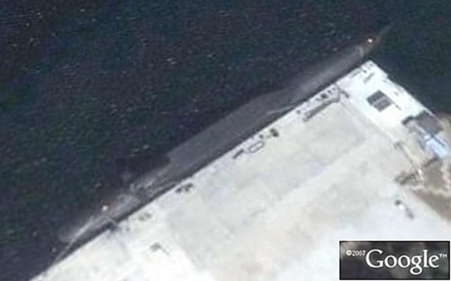 On the topic of "Ouch. Recently a Chinese Jin-class (Type 094) nuclear attack sub was picked up by a popular mapping application (not Windows Local.live.com....but the OTHER guys.) According to the Strategic Security Blog, it was imaged by a Quickbird satellite system. Of course, since this is China's newest (and probably secret) new sub, someone is probably getting an earful in Mandarin as we speak. (What's even more amazing to me is the discussion on satellite-imaging discussed in the comments section. Scary smart.) For those interested, the coordinates are: 38°49'4.40"N, 121°29'39.82"E.
Just something to be aware of, as these satellites are constantly flying overhead, snapping photos of your business, the perimeter, and other items of interest in your area. Just one more thing to consider if you have any activities that someone maybe interested in. As I've said all along, these mapping applications are often used for "target reconnaissance" and you should be checking to see what's showing up for your area. Never hurts to be aware.