SQL Server 2008 & Virtual Earth
There's a lot of buzz around Software plus Services (S+S) from Microsoft and others. It's all very simple as Eileen will tell you - it's when you use a service like GPS that's remote and public and combine it with some software like CoPilot or TomTom on your GPS to find directions.
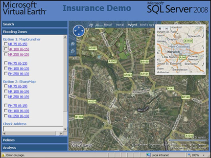
In a similar vein SQL Server 2008 can store geo-spatial data but that's of no value to a business unless they can see it and the best way to do that is on a map. If you don't have mapping software of your own then you can use a web service like Virtual Earth.
Johannes Kebeck a Microsoft Virtual Earth expert spent a morning in Visual Studio 2008 to produce an application for an insurance company which I have demonstrated in this blogcast:
Technorati Tags: SQL Server 2008,Geo-Spatial,Virtual Earth